
Disasters Charter celebrates its 20th anniversary
, marks the 20th anniversary of the International Charter "Space and Major Disasters," an international effort to put space technology at the service of emergency responders around the world.
Initiated in 1999 by the European Space Agency (ESA) and France's space agency, the Centre national d'études spatiales (CNES), the Charter was signed by the Canadian Space Agency (CSA) in , making Canada a founding member.
With 17 Charter members and 61 contributing satellites from around the world, the Charter allows for resources and expertise to be organized for a quick response to catastrophic events. When the Charter is activated, its members make satellite images of devastated regions available to support relief efforts.
From , to , there were 678 activations in 126 countries, including 14 activations in Canada.
Canada's long-standing support of the Charter
Since the Charter entered into effect in , Canada has supported relief efforts in 538 disasters worldwide by providing RADARSAT satellite images. Images from RADARSAT-1, launched in , were provided 622 times, supporting 254 activations. Images from RADARSAT-2, launched in and still operational, have been provided 1,207 times, supporting 355 activations. Canada’s latest trio of Earth observation satellites, the RADARSAT Constellation Mission (RCM), was launched in and has supported 25 activations, providing 135 images (as of ).
Below you will find some examples of when the Charter was activated and images captured by Canadian RADARSAT satellites, showing the "before" and "after" of a major disaster. Each image is a slider – the image on the left was taken before the disaster occurred; the image on the right was taken after the disaster took place. Pull the lever in the middle to see the difference.
Floods in Nepal –
In , monsoon rains caused floods and landslides in the central and eastern districts of Nepal, killing more than 100 people. Over 10,000 people were affected, 7,500 of whom were displaced from their homes.
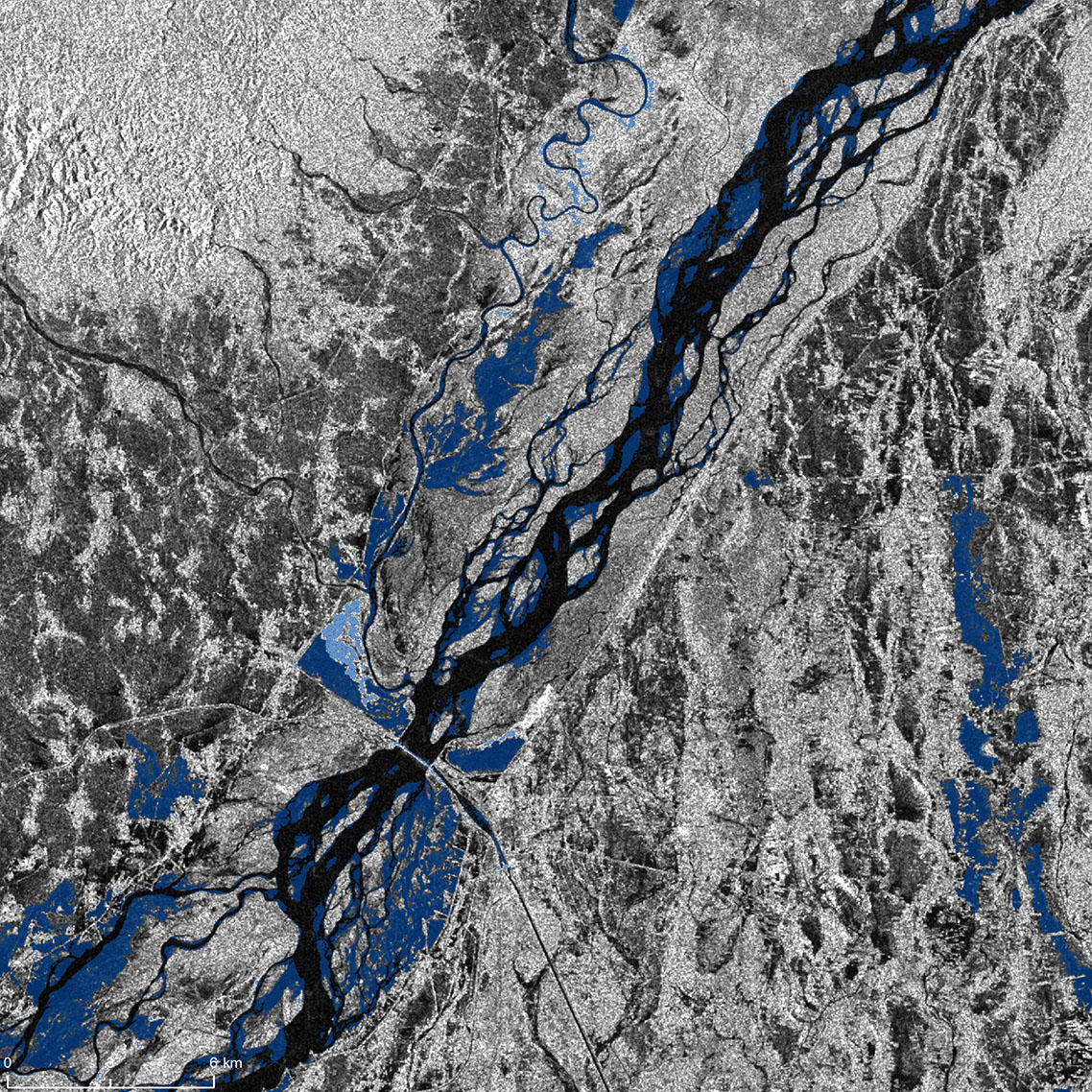
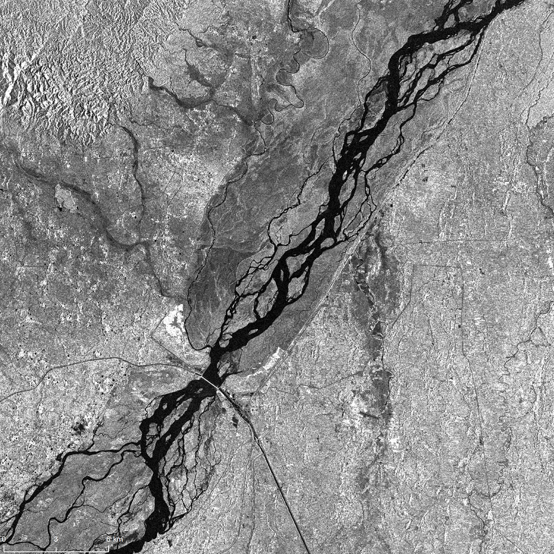
The image on the left was taken by RADARSAT-2 on , before the floods took place. The image on the right was taken by the RCM on , after the floods occurred. The water is seen in blue.
Credits: Image on the left: RADARSAT-2 Data and Products © MDA Geospatial Services Inc. () – All Rights Reserved. RADARSAT is an official mark of the Canadian Space Agency. Image on the right: RADARSAT Constellation Mission Imagery © Government of Canada (). RADARSAT is an official mark of the Canadian Space Agency.
Value-added products generated by Natural Resources Canada Emergency Geomatics Service.
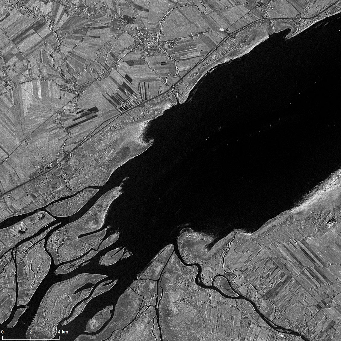
Floods in Canada –
In spring , snowmelt and rain caused flooding in parts of the Canadian provinces of Manitoba, Ontario, Quebec and New Brunswick. According to Statistics Canada, about 17,500 homes were either hit by flooding or considered to be at risk. Approximately 460 km of roadways were washed out and over 600 square km of land were flooded, including 153 square km of agricultural land. In Quebec, around 9,500 people were evacuated from their homes, while one person died in a flood-related road accident. Over 2,000 soldiers were deployed to the affected areas to help fill and distribute sandbags and assist residents.
The Charter was activated by Public Safety Canada on . Two hundred and twenty-seven satellite products were provided by eight agencies. Natural Resources Canada produced 13 maps to support relief efforts.
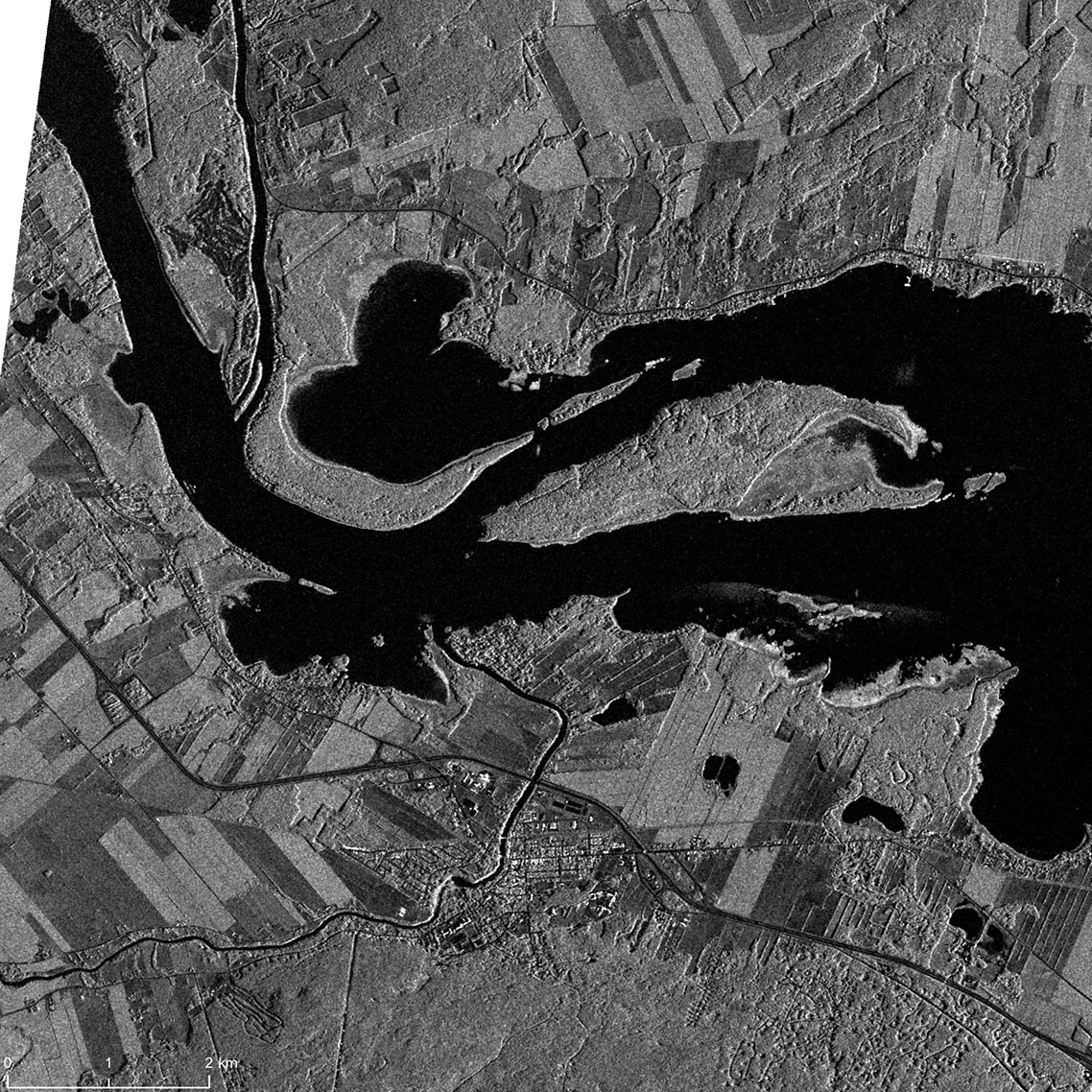
The image of Rigaud on the left was taken by RADARSAT-2 on . The image on the right was taken by RADARSAT-2 on , after the floods occurred. The water is seen in blue.
Credits: Image on the left: RADARSAT-2 Data and Products © MDA Geospatial Services Inc. () – All Rights Reserved. RADARSAT is an official mark of the Canadian Space Agency. Image on the right: RADARSAT-2 Data and Products © MDA Geospatial Services Inc. () – All Rights Reserved. RADARSAT is an official mark of the Canadian Space Agency.
Value-added products generated by Natural Resources Canada Emergency Geomatics Service.
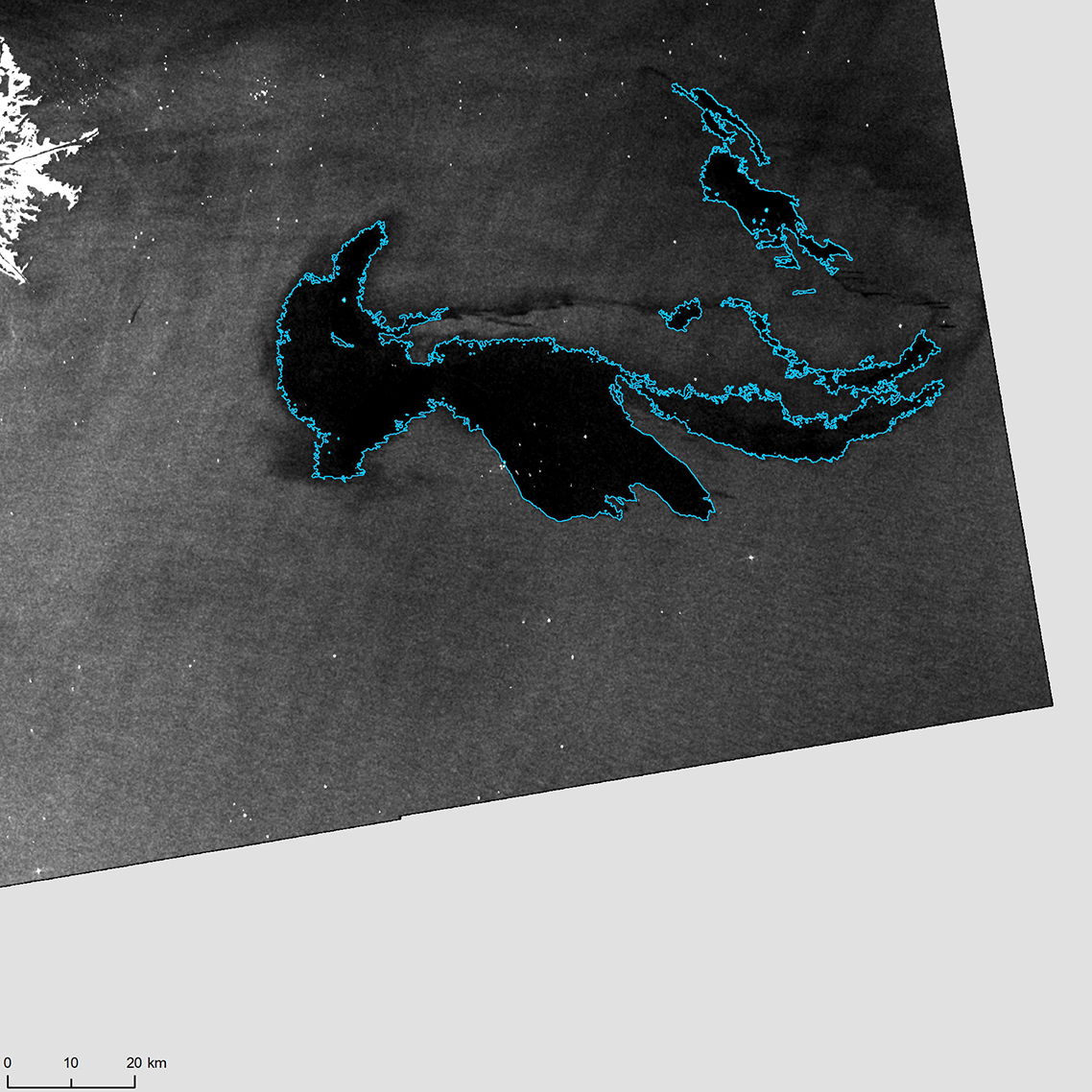
Volcano eruption and earthquake in the US –
Vigorous eruption of the Kīlauea Volcano, located on Hawaii’s Big Island, began on , and continued for months. An earthquake of 6.9 magnitude occurred the same day, and numerous earthquakes of various intensity happened after that. While no casualties were reported, the volcano’s most destructive eruption in recorded history destroyed 700 homes.
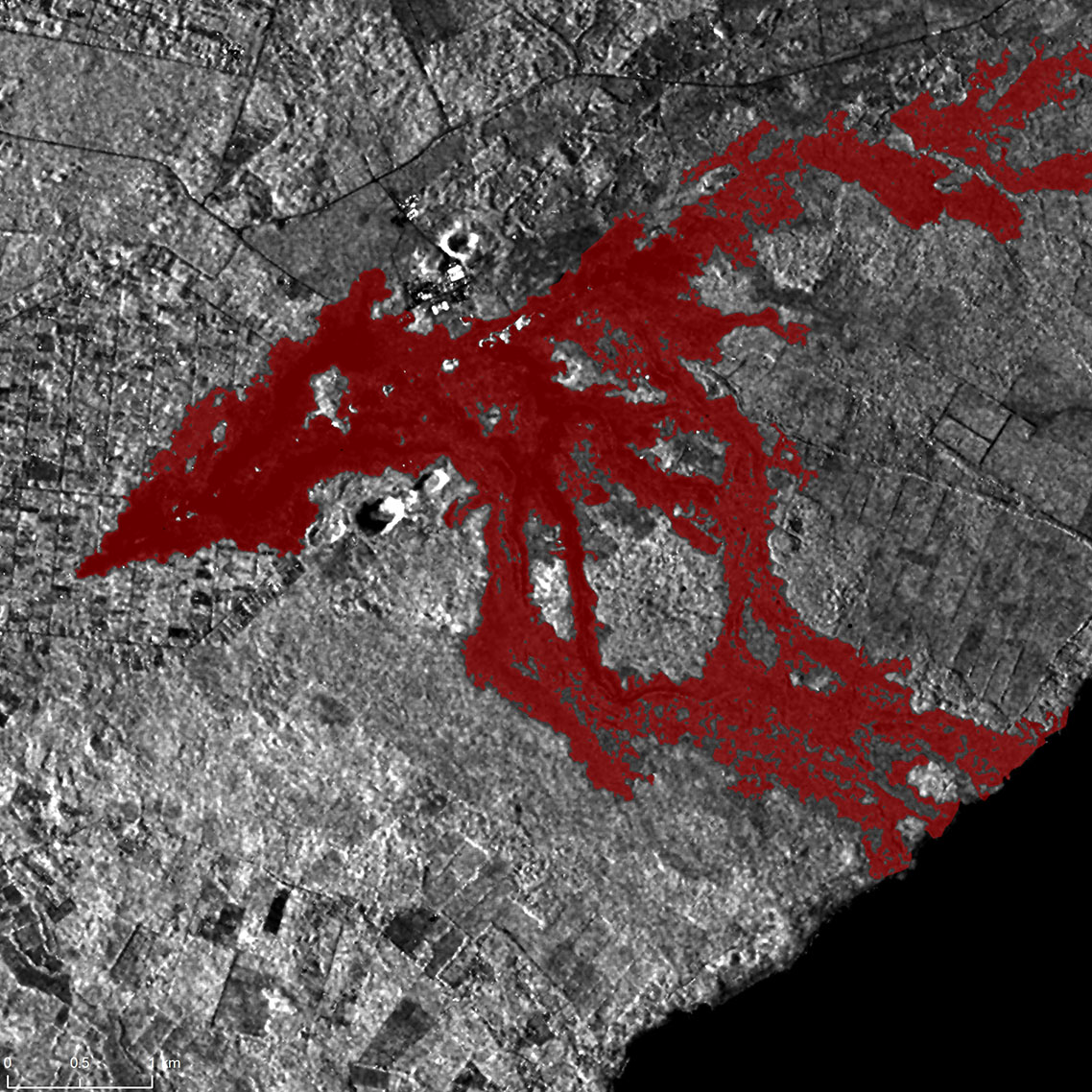
The image on the left was taken by RADARSAT-2 on . The image on the right was taken by RADARSAT-2 on , and shows one of multiple eruptions in the lower east rift zone of the Kīlauea Volcano. The lava flow is seen in red.
Credits: Image on the left: RADARSAT-2 Data and Products © MDA Geospatial Services Inc. () – All Rights Reserved. RADARSAT is an official mark of the Canadian Space Agency. Image on the right: RADARSAT-2 Data and Products © MDA Geospatial Services Inc. () – All Rights Reserved. RADARSAT is an official mark of the Canadian Space Agency.
Value-added products generated by Natural Resources Canada Emergency Geomatics Service.
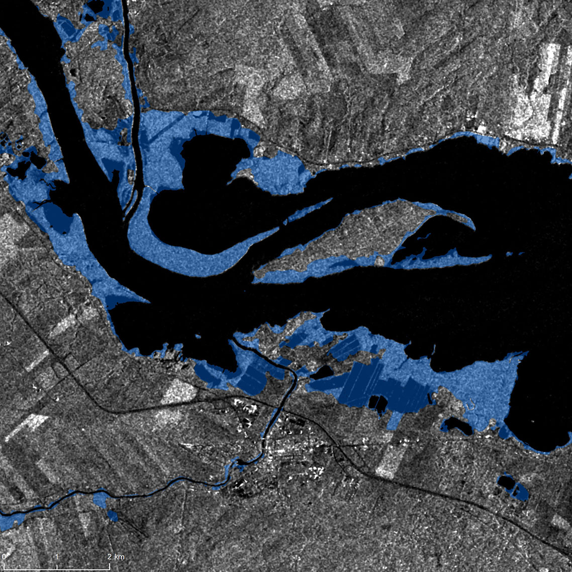
Floods in Canada –
The city of Montreal and surrounding areas were hit by severe flooding due to heavy rain and melting snow following the seasonal rise in temperature. At least 1,900 homes were flooded across 126 towns and cities in the province of Quebec. The province of Ontario was also significantly affected. There was widespread flooding in the National Capital region. In southern Ontario, the Canadian Press news agency reported that Lake Ontario's water level reached an extent not seen since .
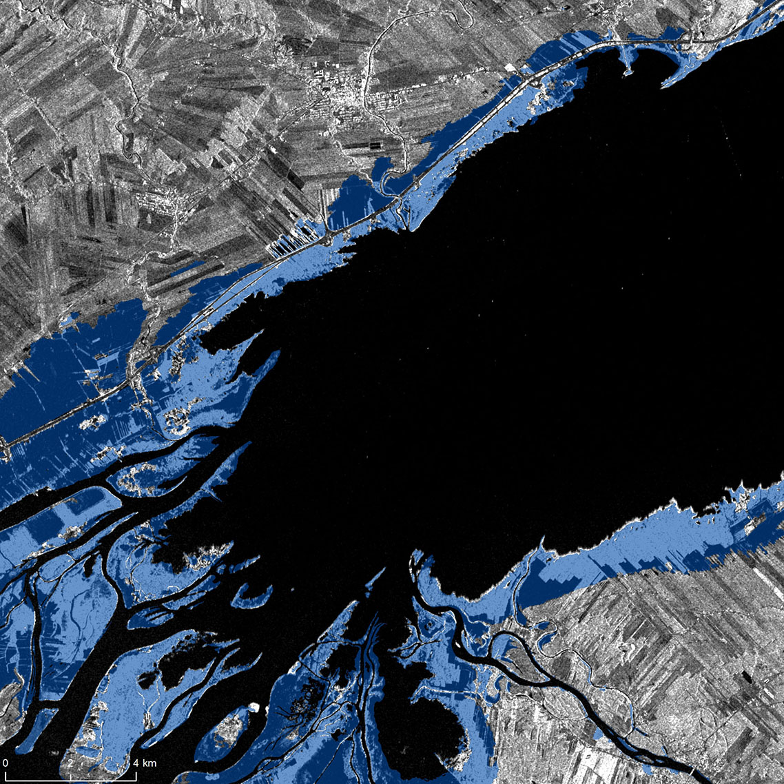
The image of Lac Saint-Pierre on the left was taken by RADARSAT-2 on . The image on the right was taken by RADARSAT-2 on , after the floods occurred. The water is seen in blue.
Credits: Image on the left: RADARSAT-2 Data and Products © MDA Geospatial Services Inc. () – All Rights Reserved. RADARSAT is an official mark of the Canadian Space Agency. Image on the right: RADARSAT-2 Data and Products © MDA Geospatial Services Inc. () – All Rights Reserved. RADARSAT is an official mark of the Canadian Space Agency.
Value-added products generated by Natural Resources Canada Emergency Geomatics Service.
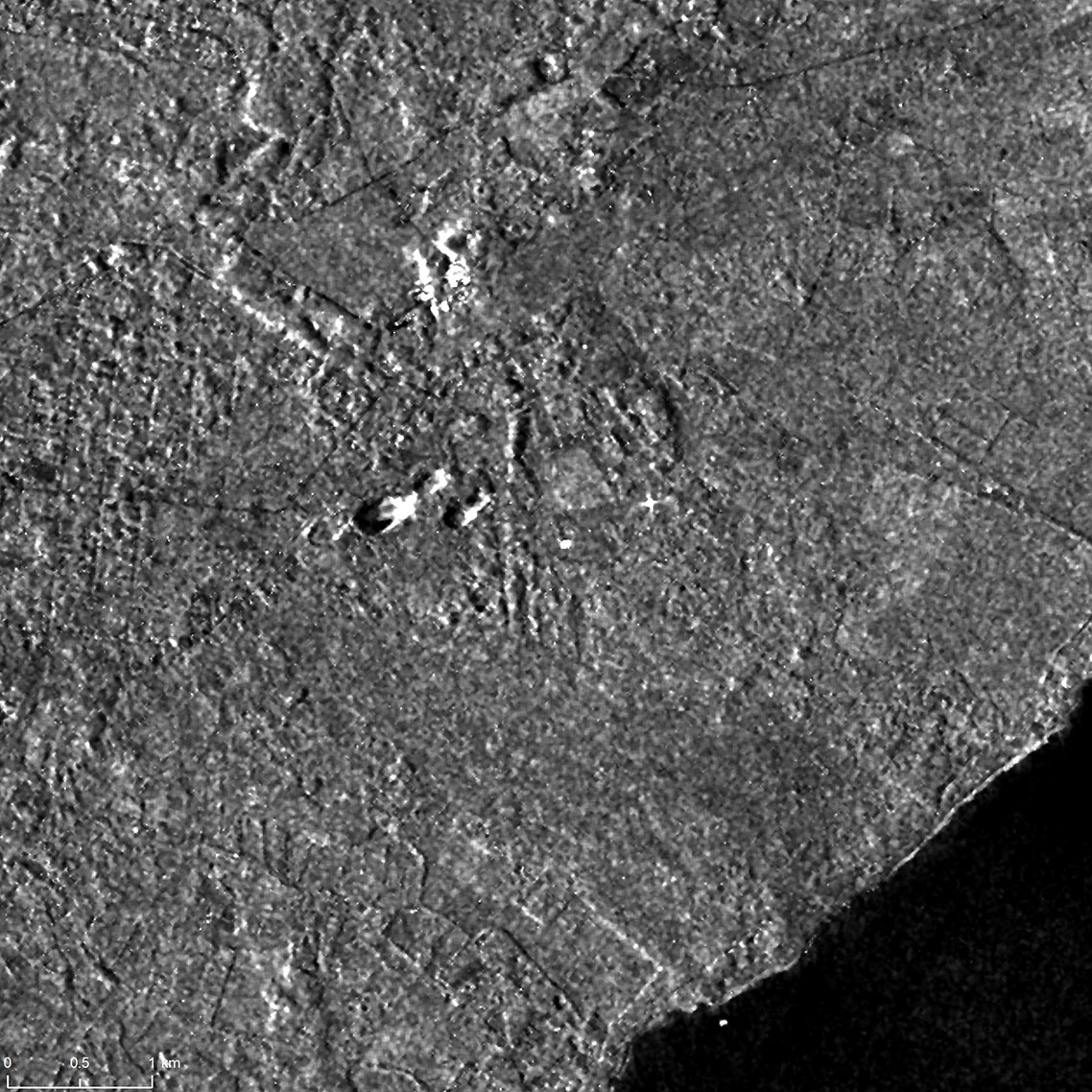
Deepwater Horizon oil spill in the Gulf of Mexico, US –
On , an explosion occurred on the Deepwater Horizon oil platform, 70 km off the coast of Louisiana. The oil drilling rig exploded and sank, killing 11 people and causing the largest oil spill in the US history.
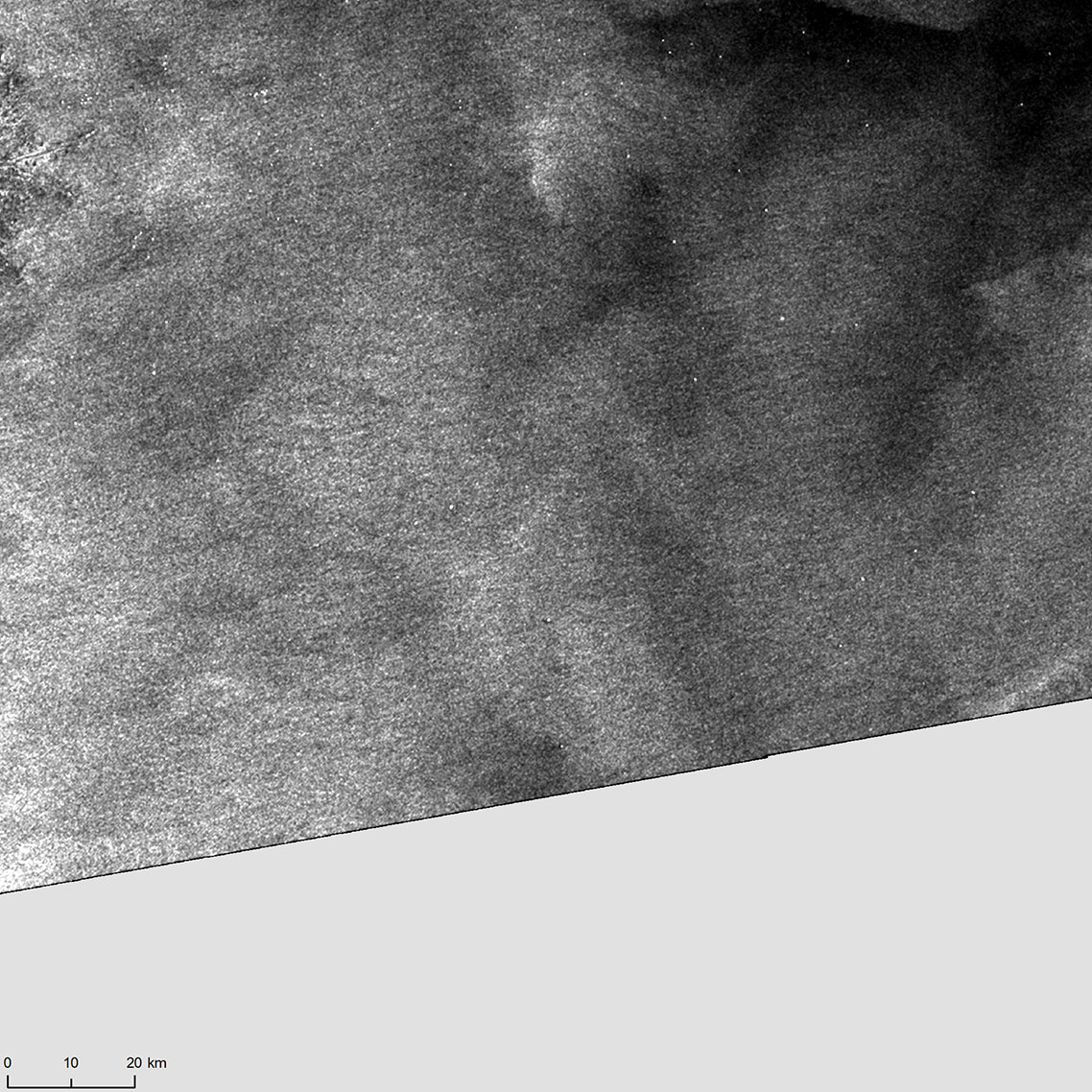
The image of waters in the Gulf of Mexico on the left was taken by RADARSAT-2 on . The image on the right was taken by RADARSAT-2 on , and shows a large oil stain.
Credits: Image on the left: RADARSAT-2 Data and Products © MDA Geospatial Services Inc. () – All Rights Reserved. RADARSAT is an official mark of the Canadian Space Agency. Image on the right: RADARSAT-2 Data and Products © MDA Geospatial Services Inc. () – All Rights Reserved. RADARSAT is an official mark of the Canadian Space Agency.
Value-added products generated by Natural Resources Canada Emergency Geomatics Service.