
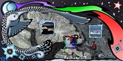
Satellite Art: celebrating Canada's beauty from space
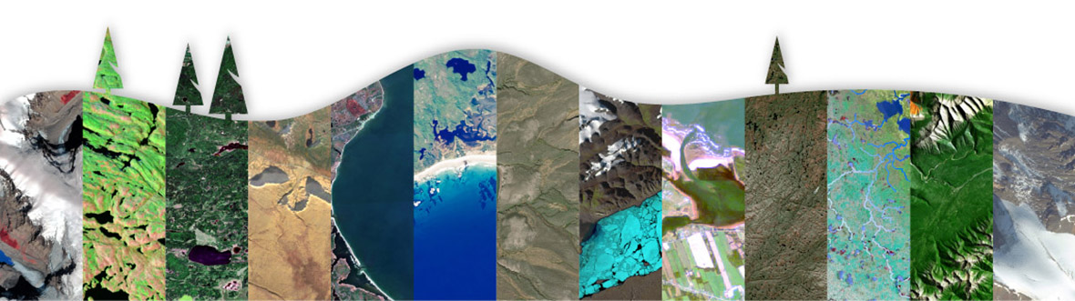
Rediscover the majesty of Canada's vast and varied landscapes through the eyes of those who use satellites to explore Earth.
We challenged 31 organizations from across the country to create stunning satellite images that showcase the natural beauty of a region in each of Canada's territories and provinces — not a typical order for companies used to treating satellite data for scientific or commercial use.
Yet, like any painter or sculptor, the specialists who process satellite data are visual artists who convey meaning through the careful selection of colour, texture, tone, shadow and shapes.
Browse this unique collection for the story behind each image, as told by those who created them.
Rediscover the majesty of Canada's national parks through the eyes of those who use satellites to explore Earth. (Credit: Canadian Space Agency)
Locations of the images in the Satellite Art gallery
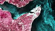
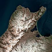
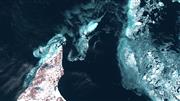
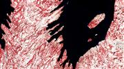
Satellite Art
| Photo | Location | Title | Company |
|---|---|---|---|
 |
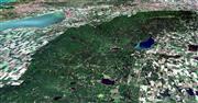
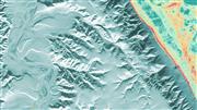
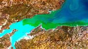
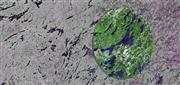
Kootenay National Park of Canada, British Columbia | Kootenay National Park | Sparkgeo |
 |
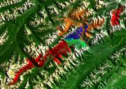
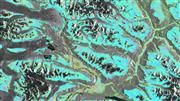
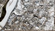
Jasper National Park of Canada, Alberta | Jasper National Park | Vertex Resource Group |
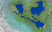 |
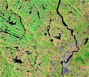
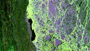
Prince Albert National Park of Canada, Saskatchewan | Prince Albert National Park | TRE Altamira Inc. |
 |
Riding Mountain National Park of Canada, Manitoba | A Prairie Oasis | NextGen Environmental Research Inc. |
 |
Pukaskwa National Park of Canada, Northeastern Lake Superior, Ontario | Pukaskwa National Park | Marcel Morin (Lost Art Cartography) |
 |
La Mauricie National Park of Canada, Quebec | Sweet Summer in Mauricie | Dromadaire Géo-Innovations |
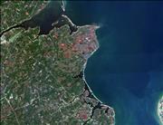 |
Kouchibouguac National Park of Canada, New Brunswick | Kouchibouguac National Park | SceneSharp Technologies Inc. |
 |
Kejimkujik National Park of Canada, Nova Scotia | Kejimkujik National Park Seaside | Paul Illsley |
 |
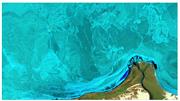
Prince Edward Island National Park of Canada, Brackley section, Prince Edward Island | Coastline where Land and Sea Meet | Arctus Inc. |
 |
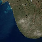
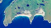
Gros Morne National Park of Canada, Newfoundland and Labrador | Gros Morne National Park | Gros Morne Co-operating Association |
 |
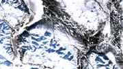
Quttinirpaaq National Park of Canada, Nunavut | Seasons at the Top of the World | H2O Geomatics |
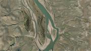 |
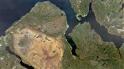
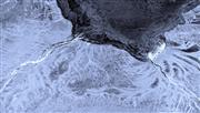
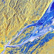
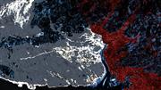
Thomsen River, Aulavik National Park of Canada on Banks Island, Northwest Territories | Serpent of the North | Esri Canada Limited |
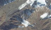 |
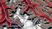
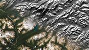
Mount Hoge, Kluane National Park and Reserve of Canada, Yukon | Kluane National Park and Reserve | Maxar Technologies |
 |
Tatshenshini-Alsek Provincial Park, British Columbia | Satellite Art that Moves You: InSAR Ground Deformation Measurements in Tatshenshini-Alsek Provincial Park, BC | 3v Geomatics |
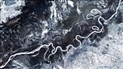 |
Peace River, Alberta | The Peace River – Frozen in Time | BGC |
 |
Saskatoon, Saskatchewan | Saskatoon, A Prairie Winter City | Western Heritage |
 |
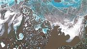
Churchill, Manitoba | Chillingly Beautiful Melt Ponds | Ducks Unlimited Canada |
 |
Moose River and James Bay, Ontario | Freeze-up in Northern Ontario – Moose River and James Bay | Cardinalus |
 |
Mont Rougemont, Quebec | Apple Capital of Quebec | Effigis GeoSolutions |
 |
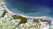
Chaleur Bay, New Brunswick | New Brunswick's Year-Round Ocean Beauty | 3D Planeta |
 |
Northern Cape Breton Island, Nova Scotia | Cape Breton Highlands of Nova Scotia with a Winter Coat of Snow | Lost Art Cartography |
 |
North Cape, Prince Edward Island | The Beauty of Sea Ice in Canada | Arctus |
 |
Conception Bay South, Newfoundland and Labrador | Winterscape | Wood Canada Limited |
 |
Mittimatalik, Nunavut | Qaamisimajuq – Blanket of Winter | SmartICE |
 |
Smoking Hills, Northwest Territories | Fire and Ice | Arctic Eider Society |
 |
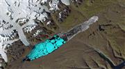
Kluane Lake, Yukon | Winter in the Yukon | Polar View |
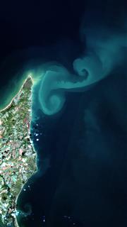 |
North Cape, Prince Edward Island | The North Cape Eddies: A Satellite Tribute to the Traditions of Prince Edward Island | Arctus |
 |
St. Lawrence River, Quebec | Winter Drift | Dromadaire Géo-Innovations |
 |
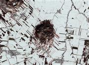
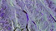
Banff National Park, Alberta | Unveiling the radar beauty of Banff National Park | TRE Altamira |
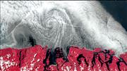 |
Pacific Rim National Park, British Columbia | A swirl of clouds at the Pacific Rim | Hatfield Consultants LLP |
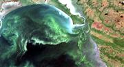 |
Lake Winnipeg, Manitoba | Beautifully Unfortunate | NextGen Environmental Research Inc. |
 |
Bay of Fundy, New Brunswick | Giraffe Meets Van Gogh in Fundy Bay, New Brunswick | Digital Earth Geomatics |
 |
Cape Spear Lighthouse National Historic Site, Newfoundland and Labrador | A Painter's Palette at the Edge of the Earth | C-CORE |
 |
Bay of Fundy, Nova Scotia | Viresco (Meaning: I will flourish, I will grow) | KorrAI Technologies |
 |
Sanikiluaq, Nunavut | Sikumiut – People of the Ice | Arctic Eider Society |
 |
Inuvialuit Settlement Region, Northwest Territories | The Floe of Time | Polar View |
 |
Rideau Lakes, Ontario | The best of both worlds | CATALYST (PCI Geomatics) |
 |
Lake Athabasca, Saskatchewan | Harmony | J.D. Mollard and Associates |
 |
Whitehorse, Yukon | Mr. Whitehorse | MDA |
Satellite Art gallery videos
Satellite Art: unique collection celebrating Canada's beauty from space. (Credit: Canadian Space Agency)
Rediscover the majesty of Canada's vast and varied winter landscapes through the eyes of those who use satellites to explore Earth. (Credit: Canadian Space Agency)
Explore further
- Date modified: