
The North Cape Eddies: A Satellite Tribute to the Traditions of Prince Edward Island
Credit: Arctus. Contains modified Copernicus Sentinel-2 data processed by ESA
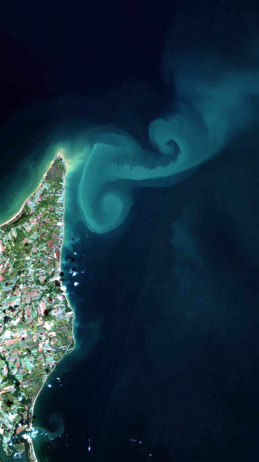
- Location: North Cape, Prince Edward Island
- Company: Arctus
North of Prince Edward Island, the meeting of currents from the Gulf of St. Lawrence and the Atlantic Ocean creates huge eddies several kilometres long, usually invisible to the naked eye. They can often be seen on satellite images, though, especially when large amounts of sand and sediment washed up from the coast by a storm remain suspended in the water and are transported over long distances for several days.
The large plume of sediment here off the North Cape is a reflection of high winds that occurred in the preceding days. These fascinating ocean swirls, shaped like fiddleheads, capture the calm after the storm and seem to pay tribute to Prince Edward Island's folk traditions.
Thomas Jaegler, geographer, enthusiast and remote-sensing specialist, brought out the natural beauty of this image acquired on , by the European Space Agency's Sentinel-2 satellite. Employed by the Quebec-based SME Arctus Inc. for the past five years, he analyzes the images captured by Earth observation satellites to study aquatic environments and better protect them.