
Sweet Summer in Mauricie
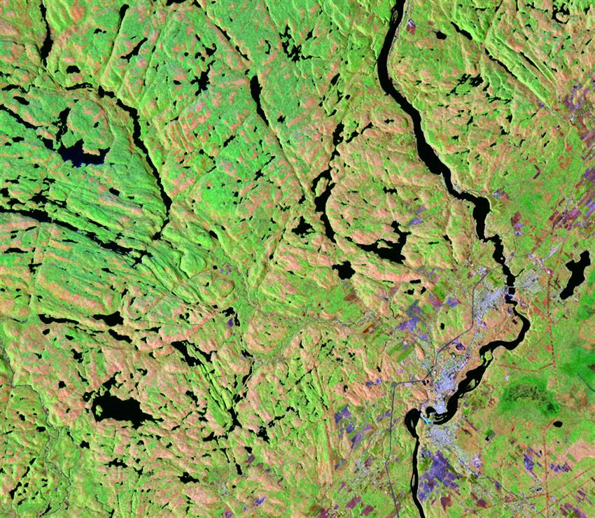
Situated on the edge of the Canadian Shield, characterized here by smooth topography and dotted with a multitude of lakes, La Mauricie National Park is a jewel of Canada's natural heritage. Home to the majestic Wapizagonke Lake, this is the ideal setting for visitors to escape from day-to-day life and breathe in the sweet scents of lush nature: a most fulfilling experience.
Credit: Dromadaire Géo-Innovations. RADARSAT Constellation Mission imagery © Government of Canada (). RADARSAT is an official mark of the Canadian Space Agency. Landsat 8 image courtesy of USGS. Contains modified Copernicus Sentinel-1 data processed by ESA
About the visual art
- Location: La Mauricie National Park of Canada, Quebec
- Company: Dromadaire Géo-Innovations
This composite is made up of three images. A Landsat image in the visible spectrum acquired on , was combined with two radar images: a RADARSAT Constellation Mission image of , and a Sentinel-1 image of . The composite makes the subtle contours look more pronounced. Because it was springtime and the leaves were not yet fully grown, it is easy to distinguish between the coniferous forests (green) and the deciduous forests (beige).