
Making travel safer for Arctic communities with RADARSAT data

I am Brian Koonoo, a resource management officer at Parks Canada. I travel a lot in the northern regions to study and compile information about the changing environment. For example, to monitor the tundra, I collect data about permafrost areas. It’s a potentially dangerous job, as we often travel by boat, by snowmobile or on foot, in cold or hazardous environments. We usually do so in groups of between two and four people to ensure safety. I use RADARSAT data to help identify what the safest routes might be. Satellite data is an increasingly important part of that process, as climate change has made traditional knowledge of the Arctic icescape less and less reliable.
Faster and safer travel on sea ice
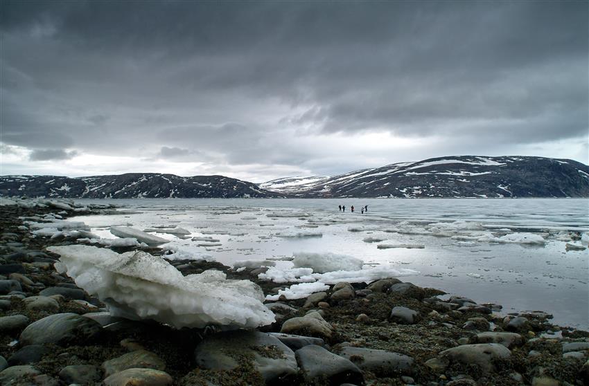
RADARSAT data enables faster and safer travel on sea ice for northern communities.
When the Canadian Ice Service introduced us to RADARSAT data in 2003–2004, I started using it immediately, almost daily. I find it particularly useful in winter and spring when the region is most dangerous, as it enables us to travel faster and safer on sea ice. We check the satellite images to determine conditions such as roughness or thinness before we go into the field. We use that information to plan our travel. RADARSAT data is especially useful when we want to travel near ice floe edges. In such cases, we use the technology to determine where it’s safe, whether there are open cracks and, if so, where they are and where we can safely cross. It’s a big improvement, because in the past, we had to rely on information passed on to us by hunters and other people who went out on the field. I prefer RADARSAT-2 data by far because of the broad range of information it provides and because it enables users to see through clouds and to identify features.
Planning hunting and fishing routes

RADARSAT data is also used to inform the locals about hunting and fishing routes.
RADARSAT really benefits those of us who live in northern communities. It helps people move around faster and better plan where they want to go. It promotes safety. It’s a tool that helps us go through our daily activities in a prudent way. For example, we use the data to inform the locals about hunting and fishing routes, through a variety of measures such as posting information in public areas. I also created the Pond Inlet Hunters information page on Facebook where people can go to check weather, satellite imagery and other data.
Brian Koonoo at a glance
Credit: Canadian Space Agency
Other RADARSAT users' stories
Explore further
- Date modified: