
Keeping people safe with timely disaster management at home and abroad
From to , 90% of major disastersFootnote 1 around the world were caused by weather-related events, such as floods and storms, with one such event occurring almost daily.
Responding to disasters quickly and efficiently is essential in order to protect people and reduce property losses. Canada's RADARSAT satellites, including the RADARSAT Constellation Mission (RCM), play a very important role in helping mitigate the impacts of disasters on the people in Canada and abroad, as part of the International Charter "Space and Major Disasters.
"
Rapid response to floods

RADARSAT data enables rescue teams to get to flooded areas quickly.
Floods are the most frequent type of natural disaster in Canada. They can take place at any time throughout the year and are usually caused by heavy rains, quick melting of snow or ice jams. Just like RADARSAT-2 does, the RCM helps emergency crews evaluate the extent of flooding in order to identify the areas affected and the seriousness of damage. RCM data is also used to predict flash floods by analyzing snow accumulation and snow melt. This enables quick deployment of enough rescue teams.
Responding to a natural disaster
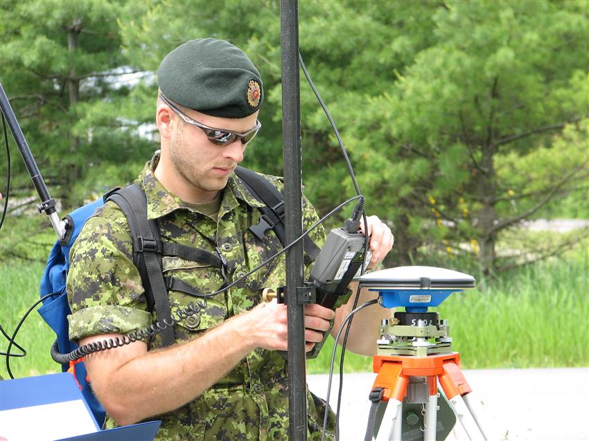
Credit: Marc Pouliot
Warrant Officer (WO) Marc Pouliot is the Chief of Geomatics for the province of Quebec within the Canadian Armed Forces (CAF). WO Pouliot is a first responder, meaning he is one of the first people to report to the scene of a natural disaster. In that role, he is responsible for rapidly taking stock of the damage in order to provide CAF decision makers on the ground with the appropriate advice. That is what he did during the floods in spring in the Montreal area, where his team was given the emergency task of analyzing and tracking the floods. WO Pouliot uses RADARSAT-2 data, to which he has 24/7 access, so that he can do his job with precision. RADARSAT data enables him to respond in a fast and effective manner in order to help Canadians in distress. Read WO Pouliot's full story.
Identifying areas at risk of landslides
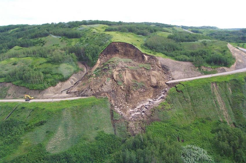
The RCM helps evaluate the extent of the damage caused by landslides. (Credit: R. Couture/Geological Survey of Canada)
Every year, thousands of landslides occur in all regions of Canada. Most landslides are small, while large ones occur once every 10 years or so. The RCM helps assess both the areas at risk of landslides and the areas already affected in order to evaluate the extent of the damage. This information helps government authorities make the best decisions about at-risk areas in order to keep their residents safe.
Supporting search and rescue teams

RCM data supports search and rescue teams at home and around the world. (Credit: Royal Canadian Air Force)
Satellites play a critical role in supporting first responders and search and rescue teams in emergency situations. By providing accurate and timely information on the location and features of disaster-stricken areas, the RCM ensures fast response time as well as a reduced risk of injury to responders during rescue operations. RADARSAT imagery is provided as needed when the International Charter "Space and Major Disasters
" is activated, enabling response teams around the world to be better equipped to save lives and limit property and infrastructure damage.
Assessing earthquake damage
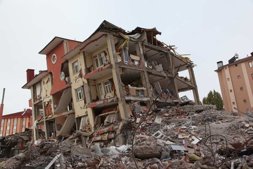
By helping detect soil movements, the RCM can aid in identifying infrastructure at risk during earthquakes.
Each year, about 5,000 earthquakes occur in Canada, most of which are small. Over the last century, at least 9 earthquakes in or close to Canada have registered a magnitude of 7 or higher. Some have caused extensive damage. RADARSAT data is very effective in helping detect soil movements. Therefore, it can be used to identify infrastructure at risk and assess earthquake damage.
Monitoring hurricanes
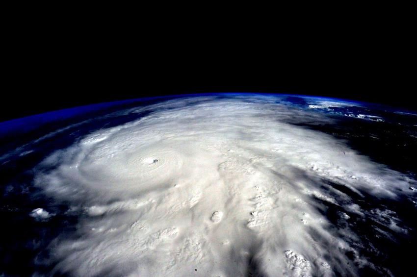
Photo of Hurricane Patricia taken by NASA Scott Kelly during his one-year mission on the International Space Station. (Credit: NASA)
From June to November, the waters of the Atlantic Ocean warm up enough to produce tropical cyclones, which include tropical storms and hurricanes. The RCM helps determine the speed and direction of the winds in order to monitor these weather events.
Explore further
- Satellites and satellite-based systems: Indispensable tools to keep us safe
- International satellites supporting disaster management
- Satellites serving Earth
- Date modified: