
WildFireSat: Enhancing Canada's ability to manage wildfires

- Launch:
- Mission duration: five years with possibility to extend
- Mission status: in development
This Canadian initiative will enhance Canada's ability to manage wildfires in the country. It aims to monitor all active wildfires in Canada from space on a daily basis. (Credits: Canadian Space Agency, Natural Resources Canada, Canadian Forest Service, Canadian Interagency Forest Fire Centre, BC Wildfire Service, Ontario Ministry of Natural Resources and Forestry. Aviation, Forest Fire and Emergency Services, Yukon Wildland Fire Management, European Union Space Programme (Copernicus Sentinel-2 data, processed by Dromadaire Géo-Innovations), NASA Earth Observatory image by Joshua Stevens, using Landsat data from the U.S. Geological Survey, NASA Earth Observatory, Lauren Dauphin and JoshuaStevens, VIIRS data from NASA EOSDIS/LANCE,GIBS/Worldview, and the Suomi National Polar-orbiting Partnership,, Landsat data from the U.S. Geological Survey, and GEOS-5 data from the Global Modeling and Assimilation Office at NASA GSFC)
A Canadian challenge
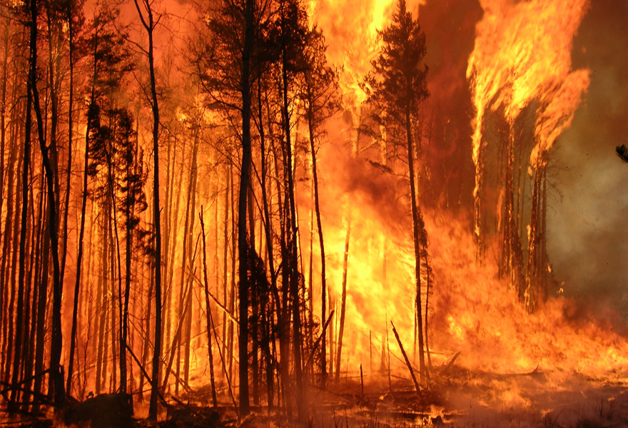
Eighty-eight percent of Canada's 4 million km2 of forested lands is characterized as boreal forest, and is home to some of the largest and most intense wildfires in the world. Every year, Canada sees about 7,500 wildfires burn over 2.5 million hectares of forest, a territory about half the size of Nova Scotia.
The amount of forest burned by wildfire is projected to double by due to our changing climate, which is causing longer wildfire seasons, more extreme weather conditions and increased droughts.
Wildfires are a serious challenge in Canada. (Credit: CFS)
On average, about 3% of wildfires are very large and uncontrolled. Ultimately, these 3% of wildfires cause about 97% of the burned area. By increasing our capabilities to better anticipate which wildfires have the potential to burn out of control, they can be prioritized for suppression, leading to a drastic reduction in the economic losses related to wildfire.
Canada's cost of fighting wildfires
Canada spends about $1 billion annually combatting wildfires. However, indirect costs may rise to several billion dollars per year stemming from property loss, damaged infrastructure, industrial shutdowns, evacuations, health-related expenses, and economic losses in a variety of sectors including tourism, forestry, and energy. The Fort McMurray wildfire was the most expensive natural disaster in Canadian history, with a total cost of approximately $9 billion.
The WildFireSat mission
The planned WildFireSat mission aims to monitor all active wildfires in Canada from space on a daily basis. It is an initiative of:
- the CSA
- the CFS and the Canadian Centre for Mapping and Earth Observation (CCMEO), both part of Natural Resources Canada (NRCan)
- Environment and Climate Change Canada (ECCC)
The primary goal of WildFireSat is to support wildfire management. In addition, it will provide Canadians with more precise information on smoke and air quality conditions. It will further enable us to more accurately measure the carbon emitted by wildfires, an important requirement of international agreements on carbon reporting.

WildFireSat will provide Canadians with more accurate information on smoke and air quality. (Credit: CFS)
A Canadian initiative
Canada is a world leader in wildfire management and research. Canadian wildfire managers are working to address the challenges of increased wildfire activity through modernization of their tools and policies. Current remote sensing tools are not adequate to obtain the data that wildfire managers need to carry out their challenging tasks. Innovative Canadian technology is now available to build an affordable space solution to provide wildfire managers with the tools they require.
In a country as vast as Canada, observation from space is the only way to get information on all active wildfires, every day, with the precision that wildfire managers need to do their job. WildFireSat will give us a complete inventory of wildfire activity in Canada at a crucial time of the day and an understanding of the regional and inter-annual variations that occur.
WildFireSat will benefit Canadians
WildFireSat will reduce wildfire losses through more precise wildfire monitoring, improving our ability to make informed decisions about defending communities and avoiding unnecessary evacuations. It will allow us to better protect our resources, infrastructure, and environment by providing better situational awareness, particularly near inhabited areas. It will help reduce health problems associated with smoke and air pollution. It will assist in preventing disastrous wildfires through improved decision making. It will solidify Canada as a world leader in wildfire management and research and in the deployment of breakthrough wildfire management technology in space.
The North
Wildfires in Canada are managed in different ways depending on how close they are to people, infrastructure, or cultural and economically valuable locations. This often means that the further north a wildfire is, the more room it has to burn without threatening Canadians. In northern Canada where population is sparse, wildfires are often left to burn, performing their natural function of regenerating these ecosystems. Even still, these remote wildfires need to be watched closely (often by aircraft survey) to ensure they are not approaching vulnerable areas. WildFireSat will allow wildfire managers to stay better informed about the status of wildfires in the North, without the need for constant costly flights.
What will WildFireSat measure?
The WildFireSat system will consist of satellites equipped with infrared sensors that will measure the energy emitted by wildfires. This energy is referred to as Fire Radiative Power (FRP). With FRP information, essential characteristics of wildfires such as fire intensity and rate of spread can be derived. It will also give us accurate data on carbon emission from wildfires.
Improved wildfire management

Data provided by WildFireSat will help prioritize which wildfires to fight. (Credit: CFS)
On any given day with significant wildfire activity, hundreds of wildfires can be burning in one province or territory at the same time. With limited resources available for wildfire suppression, at times wildfires must be prioritized, with only the most critical wildfires being fought. The measurements taken by WildFireSat, together with other information such as wind direction, topography, and dryness of the area, will give wildfire managers the ability to determine which wildfires are high risk and should therefore be prioritized.
Accurate smoke forecasting

Wildfire smoke has a severe impact on air quality. (Credit: CFS)
Smoke from wildfires can travel great distances and severely degrade air quality. The Fort McMurray wildfire affected air quality for a large area that stretched all the way to Florida.
WildFireSat will be able to provide more accurate data on the smoke coming from wildfires, allowing smoke forecasts to be updated and improved for organizations and citizens that need the information.
Air quality forecasting
ECCC produces daily forecasts of the Air Quality Health Index (AQHI), a scale designed to help Canadians adjust their activity levels depending on their individual health risk from air pollution. Since wildfires are often responsible for reduced air quality, it is necessary to collect better data on wildfires in order to improve the accuracy of the AQHI and other air quality advisories. WildFireSat will offer more precise and timely monitoring of wildfires and their characteristics, as well as further refinement of remote sensing algorithms.
Carbon emission monitoring

Wildfires release large amounts of carbon into the atmosphere. (Credit: CFS)
A recent estimate suggests that in British Columbia in , emissions directly resulting from wildfire amounted to 150 million tons of carbon dioxide. That is two to three times the emissions from fossil fuel burning and other activities in all categories of that province's greenhouse gas inventory. In Canada, annual carbon emissions from wildfires can equal the annual carbon emissions from burning fossil fuels across the country.
With the information on FRP from WildFireSat, we will be able to calculate how much carbon is released into the atmosphere by wildfire. This data is essential for carbon emission reporting as agreed upon under the United Nations Framework Convention on Climate Change.
Gap in wildfire observations from space
Existing satellites with infrared sensors can observe wildfires. However, for a period of several hours in the afternoon and early evening, none of the required satellite images are currently available. This long blackout period corresponds to the most critical period of wildfire activity, i.e. the late afternoon "peak burn period." During that period, higher daily temperatures, lower humidity and strong winds often result in a rapid propagation of wildfires.

In this illustration, coloured bars show the overpass times of various existing satellites that are used for wildfire management purposes: Terra (dark green), Aqua (blue), Suomi NPP (purple), Sentinel-3 (light green), Sentinel-2 (orange) and Landsat 8 (pink). WildFireSat aims to fill a crucial gap in peak burn wildfire monitoring, and to be used in conjunction with existing systems. (Credit: CFS)
Principal investigator
Dr. Josh Johnston is the principal investigator of the WildFireSat mission. Josh is a forest fire research scientist with NRCan's CFS, and was formerly a firefighter. His research focuses on the development of remote sensing tools for studying the physical properties of combustion and fire behaviour, as well as the adaptation of remote sensing tools for operational wildfire management. Josh has been collaborating with the CSA since on activities leading up to the realization of WildFireSat.
Scientific objective
WildFireSat will support research on the behaviour of wildfires and the emission of carbon, aerosols and other particles that wildfires produce. By providing a key observation of wildfire activity and FRP during the peak burn period, WildFireSat will work with existing satellites to significantly broaden our understanding of how wildfires behave and how that behaviour is changing alongside our climate.

Dr. Josh Johnston of the CFS, the principal investigator of the WildFireSat mission, is conducting fire suppression effectiveness studies at the Rose Experimental Burn Station near Thessalon, Ontario. (Credit: CFS)
Uncooled infrared sensors
WildFireSat will use infrared sensors to measure energy coming from wildfires. Normally, infrared sensors must be cooled down to extremely low temperatures using heavy cooling equipment with high energy demands. A satellite with such equipment is very large and expensive. One of the unique things about WildFireSat is that it will use an innovative type of infrared sensor, based on microbolometer technology, that does not need to be cooled. The CSA has invested in the development of this technology in recent years through its Space Technology Development Program. The use of this technology drastically reduces the weight and size of the satellite and the amount of power required to operate it, thereby considerably reducing the cost of the satellite.
WildFireSat data publicly available
All processed and calibrated WildFireSat data will be accessible to the public as soon as it becomes available, in accordance with the CSA's commitment to open government.
Future possibilities beyond WildFireSat
With multiple sensors in space, we would be able to observe wildfires more frequently, giving wildfire managers updates on all of Canada daily or even multiple times throughout the day. This type of very frequent monitoring would be unrealistic with the traditional type of cooled infrared sensor, but is a possibility with the uncooled infrared sensor. Because of their limited physical resource requirements, WildFireSat's uncooled infrared sensors would make an excellent addition to the satellites of tomorrow.
Watch the NRCan video WildFireSat, a mission tailored to the needs of wildland fire management in Canada to learn more about how wildfires are managed in Canada.
Explore further
- Satellites and satellite-based systems: Indispensable tools to keep us safe
- Monitoring and protecting our ecosystems from space
- Satellites serving Earth
- Date modified: